Geothermal Resource Group offers Exploration and Geoscience consulting services through our highly experienced geothermal geologists, tailored to the needs of individual clients, whether you have a greenfield prospect, are reaching into a new part of an existing field, or are targeting wells in an established field. Services include exploration planning, geological modeling, conceptual modeling, exploration activities field supervision, data analysis, pressure/temperature logging, and well testing.
GRG can assist with the initial site investigation, including existing documentation and data review, data mining, and geologic mapping. This includes preparation of preliminary site assessment reports and recommendations for initial-stage development activities.
GRG, with a small permanent staff, has the freedom to partner with the specialists needed to complete each project efficiently with the right expert for the project. GRG has partner relationships with many subject experts, to add to the in-house expertise as needed, whether that be a specialist geophysicist, geochemist, modeler, or geologist.
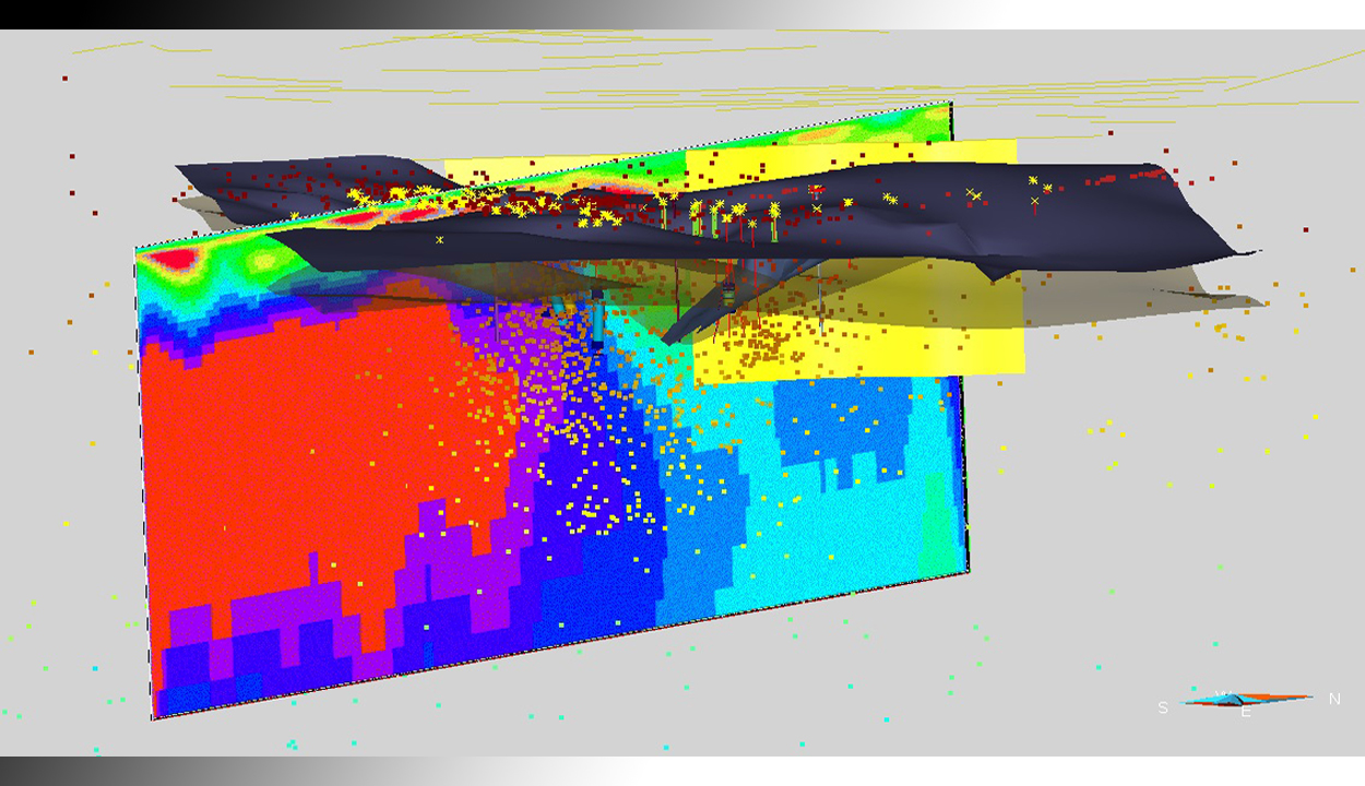
Geothermal resources are found all over the world in many geologic settings. The geothermal potential of a given area is dependent on the temperature and the porosity and permeability of the host rocks. Techniques for identification of traditional geothermal resources used for electricity generation include geologic, geochemical and geophysical study to determine the size, depth, temperature and fluid characteristics of the geothermal system. Drilling should proceed after the less expensive studies have been completed and a clear conceptual model is used to select drilling targets that will further the understanding of the commercial resource. This strategy will lead to the most productive use of drilling dollars. GRG can assist by creating an exploration plan with clear milestones and decision points. Through the use of 3D geologic modeling in the development of the conceptual model, the available data is integrated so that data gaps and development risk can be assessed.

Visit Our YouTube Channel on this Subject!
Reservoir Engineering & GeoScience - https://youtu.be/nBILwVjrBeU